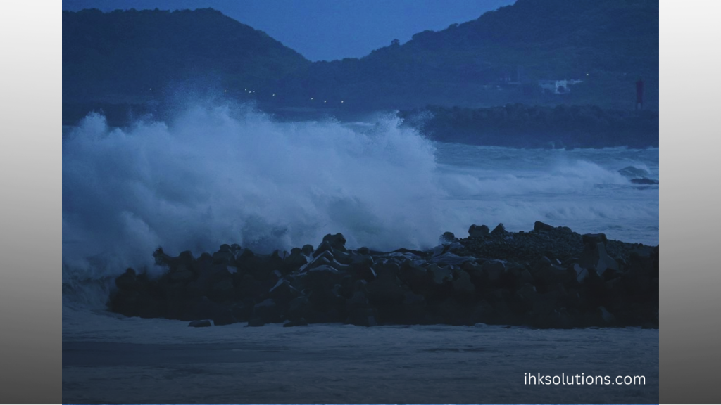
Typhoon Shanshan is impacting the southern parts of Japan, bringing a series of effects that will affect much of the archipelago. Emergency warnings for heavy rain, strong winds, high waves, and storms are in effect in the Miyazaki, Kagoshima, and Ehime prefectures in southwestern Japan, with additional warnings for landslides in those areas and Shizuoka Prefecture.
The typhoon appears to have made landfall near Makurazaki in southern Kyushu, Japan’s southwesternmost main island, on Thursday morning local time.
As it made landfall, storm chaser James Reynolds reported “occasional complete power outages” due to sheets of rain driven by the winds. Another storm chaser, Jonathan Petramala, captured footage of swirling curtains of rain. He posted on X, saying, “This scene reminds me of the Dementors from Harry Potter.”
Wind speeds in Makurazaki reached 85 miles per hour as the storm moved inland. Some areas in southern Kyushu received more than 15 inches of rain between Wednesday and Thursday morning.
The storm peaked with the strength equivalent to a Category 4 hurricane on Tuesday and Wednesday, striking Amami Oshima Island and hitting Kikai Airport on Kikaijima, a small Japanese island north of Okinawa, with wind gusts of around 100 miles per hour. Mid-level vortices, or smaller swirls inside the eye, were visible on radar as the storm reached its peak intensity, a sign of a powerful typhoon.
By the time it made landfall early Thursday, the slow-moving storm had weakened to the strength of a Category 2 hurricane. It is expected to weaken further as it moves inland.
Strong winds had already caused power outages for 66,000 homes in Kyushu. In Miyazaki, Kyushu, 6,000 homes were evacuated.
According to the Joint Typhoon Warning Center, Shanshan had maximum sustained wind speeds of 95 to 100 miles per hour in its eyewall—the ring of intense thunderstorms surrounding the storm’s center—early Thursday morning. The storm may have been producing a storm surge of about two meters (6.6 feet) between Makurazaki and Ibusuki in southern Kyushu.
Until the typhoon’s circulation becomes fully inland, water will continue to accumulate in Kagoshima Bay, potentially flooding low-lying areas. This issue is exacerbated by Shanshan’s slow forward speed.
Fortunately, the tsunami-prone coastline of Kagoshima City is largely protected by sea walls and is elevated enough above sea level that most infrastructure can escape with minimal impact. However, the fierce winds, reaching up to 100 miles per hour, could still cause some damage.
One of the most serious risks facing Japan is flooding from the heavy rainfall. While building codes require structures to be resilient to typhoon winds, the country’s mountainous terrain poses a significant vulnerability to rain-induced landslides.
At least one landslide has already destroyed a home in Gamagori, in western Honshu—Japan’s main island, and more landslides are likely as heavy rain moves ashore.
As of Thursday, Shanshan’s strong winds will continue spreading across Kyushu, with tropical storm-force winds extending over Shikoku Island to its north.
Currently, Shanshan is facing a kind of atmospheric pressure standoff. It’s stalled between two high-pressure systems. Its only option is to travel north to northeast between these systems, allowing the storm to approach Japan.
For now, this movement will bring it to southern Japan, but uncertainty remains beyond that. Typhoon Shanshan is too far from any low-pressure systems to the north that could help push it northeast. There’s a chance the typhoon could loop back to the coast and strengthen again. However, the official forecast from the Japan Meteorological Agency predicts the storm will move northeast, affecting nearly all of Japan.
This could result in up to 25 or even 30 inches of rain in the mountains of southwestern Japan, with amounts ranging from 5 to 10 inches common elsewhere along the southern coast and windward mountain slopes. Further north, totals of 3 to 5 inches are likely.
Tokyo could see scattered rain showers over the weekend, with stormy winds on Friday and Saturday.

